From Paint Bank, VA:
From the Paint Bank General Store (Texaco station)/Swinging Bridge Restaurant on Highway 311, turn left (south) onto VA-600.
Continue south on VA-600 for 3.2 miles to where it enters West Virginia and changes names to WV County Road 17. (600/17 is a relatively straight valley-road).
Continue on West Virginia CR-17 for another 7.5 miles.
Turn right (northwest) onto County Road 15 (marked Limestone Hill Road upon a green and white street sign. Limestone Hill Road used to be named "Gap Mills/Waiteville Road").
Continue on CR-15, which traces its way up Peters Mountain, for 4-plus miles until reaching the ridgetop.
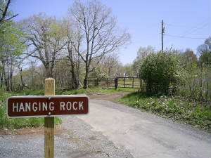
At the ridgetop on the left (south) is a gravel public parking lot for the Allegheny Trail and Hanging Rock Raptor Observatory.
Across the street (north) from the parking lot is a large, brown pipe gate.
The launch is located 175 yards up the private road after crossing through the brown pipe gate.
Launch
N 37* 30.638'
W 80* 26.060'
DM.MM format
From Gap Mills, WV:
In Gap Mills, turn onto Zenith Road (County Road 29). This is Zenith Road's northern terminus, and it is just south of the Cheese n' More Store.
Continue south on Zenith Road (CR-29) for 3-plus miles.
Turn left onto Limestone Hill Road (County Road 15) [the green and white street sign names it Limestone Hill Road but it used to be named Gap Mills/Waiteville Road].
Continue up Limestone Hill Road (CR-15) to the ridgetop.
At the ridgetop on the right (south) is a gravel public parking lot for the Allegheny Trail and Hanging Rock Raptor Observatory.
Across the street (north) from the parking lot is a large, brown pipe gate.
The launch is located 175 yards up the private road after crossing through the brown pipe gate.
Launch
N 37* 30.638'
W 80* 26.060'
DM.MM format